Select one of the options below:
Deepen your engineering knowledge as you gain the foundation to take on new and complex challenges in the field.
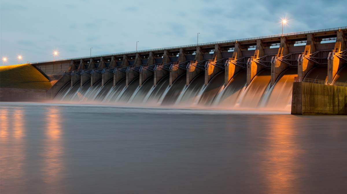
With an ever-growing population, today's civil engineers face the challenge of building and maintaining a sustainable infrastructure. One of our most critical resources is water, and the focus of this degree program prepares you to tackle the evolving water concerns facing future generations. Colorado State University is a leader in water-related issues and one of the few institutions providing an online master's in civil engineering with a focus on water resources engineering and management.
Learn from engineering faculty with a wealth of knowledge and experience in:
Global population growth has increased demand for the development and maintenance of sustainable infrastructure to address water-related issues. Be prepared by studying topics such as:
Learn about the most recent industry research, so you will be ready to tackle infrastructure-related issues and changing water concerns. You will gain the skills to leverage engineering concepts and computer technology to create a more sustainable infrastructure for generations to come.
In 2023, CSU was ranked one of the most affordable universities for an online master’s degree in civil engineering by OnlineU.com.
Professor
Borland Professor of Water Resources
Professor
Civil and Environmental Engineering
Professor
Civil and Environmental Engineering
Professor
Civil and Environmental Engineering
Associate Professor
Borland Professor, Civil and Environmental Engineering
Professor
Civil and Environmental Engineering
Professor
Borland Professor and CSU Monfort Professor
An advanced degree in engineering provides you with the skills and knowledge to handle the new engineering problems that arise from our industrial-oriented society. By becoming a more environmentally-educated engineer, you will be well situated to pursue green positions, helping with areas such as water purification, flow, containment and transport. Consulting firms, industrial firms, and governmental agencies want engineers with advanced training in water resources engineering, systems analysis and optimization, hydrology, hydraulics, and civil engineering infrastructure.
Civil engineers with a focus on water resource engineering are needed in the global marketplace, though specific career opportunities depend on the desired region and job market. As a civil engineering graduate you'll find outstanding employment prospects in public works, private consulting or regulatory organizations, and government or military agencies.
In a recent study conducted by EMSI, it was determined that civil engineering is among the top 25 occupations facing potential skill shortages. This suggests that workers have failed to acquire the education employers are looking for. This paired with a predicted 19% rate of growth in the industry's employment opportunities, according to the Bureau of Labor Statistics, offers an optimistic jobs outlook. Prepare yourself to meet market demand with a civil engineering master's degree.
You are encouraged to ask instructors about prominent regions for degree application and salary ranges. Professors may be able to connect you to valuable career resources, including job opportunities with private organizations or public agencies.
Matt’s love of rivers started when he was just 16, working as a rafting guide. See how CSU’s online civil engineering master’s gave him the opportunity to put his passion to work.

“The information in this program was very applicable to my career. It helped me become a better, more developed engineer. My GIS courses allowed me to take my skills to another level. I apply what I learned in the pipeline and stormwater courses regularly in my daily job duties.”

“This program taught and prepared me to better use technology in the field, especially GIS and modeling tools. The case studies and literature prepared me to form defensible and sound engineering judgements. The professors prepared me to solve real-world challenges.”

“I wanted to switch disciplines from working at a natural gas utility to storm water design, but I struggled to get my foot in the door. Now I’m doing the work I really wanted to do and enjoying my career path. Much of what I learned in this program has direct connections to my job. I also learned to apply new ideas, such as incorporating GIS into projects to make a project more meaningful to the end user.”
“Before completing the program, I had the seeds of ideas that could improve processes at work, but I wasn’t able to execute the ideas or build the tools. Since moving through this program, I have enhanced my abilities to create new and improved workflows, carving out an important role on my team at work.”
All courses are delivered online via our learning management system called Canvas. The system allows you to watch recorded, campus-based lectures, engage in course content and communicate with peers online. Courses are asynchronous, allowing you to study at the time that best fits your schedule. Take a look at this engineering course capture to get a feel for the online student experience in our programs.
In your courses you will:
Although the online format of this degree offers flexibility, it still requires the same amount of work and time as an on-campus graduate program. Depending on your learning and studying style, expect to spend nine to twelve hours per week on a three-credit course. This will vary depending on your learning and studying style.
Your interactions with faculty depend on the specific course, but generally, your instructors have online or telephone office hours and are available by email or via course discussion boards.
This online program allows you to earn your degree while maintaining your busy work and family schedules.
No. The Master of Engineering is a coursework-only (Plan C) degree.
No. Scholarships are not available, but financial aid is available.
Civil engineers with a focus on water resource management are needed in a global marketplace, though specific career opportunities depend on the desired region and job market. You are encouraged to ask instructors about prominent regions for degree application and salary ranges. Professors may be able to connect you to valuable career resources, including job opportunities with private organizations or public agencies.
For this online program you can expect a similar workload to a traditional on-campus program. You can expect to spend approximately nine to twelve hours per week preparing for each three-hour course.
Possibly. A B.S. in engineering is not required for the M.E. degree. However, certain prerequisite coursework is required. For detailed information visit the Application Requirements - Non-B.S.E. Students page.
| Fall semester | May 1 |
| Spring semester | December 1 |
Start your application online and upload materials directly into the online system. You can save your progress and return any time.
Apply NowNote that meeting the minimum department standards does not ensure admission to the program. Admission to Colorado State University graduate programs is based on a number of factors, including prior academic and professional experience and the personal statement.
Prepare the materials below and upload when you apply online.
Complete the online graduate application form and pay the nonrefundable application processing fee (payable online). As soon as you have completed the required information, please submit your application. Your application will not be reviewed until it is complete and all required materials have been received.
Request one official transcript of all collegiate work completed from all institutions attended. Transcripts from Colorado State University are not required. Transcripts must be received directly from the originating institution to be considered official.
Electronic (preferred): Digital Transcripts must be submitted by the originating institution using a secure service such as parchment, eScrip-Safe, the National Student Clearinghouse, or e-Quals. Transcripts received via emails are considered unofficial. Use institution code 4075 for Colorado State University or gradadmissions@colostate.edu if the secure service requires an email address.
Mail (if necessary) Graduate Admissions Colorado State University – Office of Admissions 1062 Campus Delivery Fort Collins, CO 80523-1062
GRE test scores are not required to apply for the Master of Engineering program. However, if you would like to submit GRE scores, you may do so through the Educational Testing Service (select institution code: 4075, leave the department code blank). Scores are typically received by the University 4-6 weeks after your testing date.
View your application status at any time to ensure your application checklist is complete or to check on updates.
Once your complete application, including supporting materials, is received, the department admission committee will review your application and notify you of their decision.
Proof of English language proficiency is required for applicants from countries or United States territories where there are official languages other than (or in addition to) English. This includes the U.S. territories of American Samoa, Guam, the Northern Mariana Islands, and Puerto Rico.
We love learning about your goals and answering any questions you have.